Project Overview
In April 2023, I participated in a 3-week competition to predict the Leaf Area Index (LAI) for each pixel in satellite images from Sentinel-1 and Sentinel-2. The project combined remote sensing, computer vision, and deep learning, and led to a publication at the Big Data from Space (BiDS) 2023 conference in Vienna, Austria.
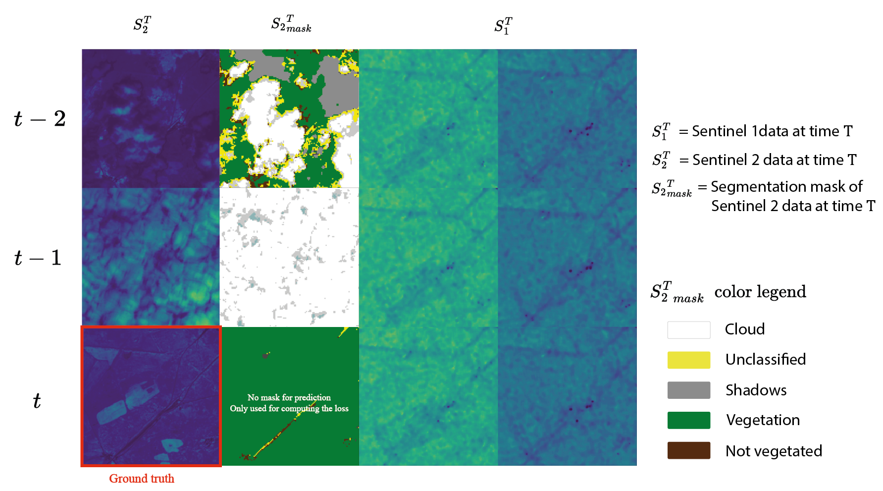
Wang, C., Debouchage, A., Goldité, V., Wery, A., & Salzinger, J. (2024). Leveraging Multi-Temporal Sentinel 1 and 2 Satellite Data for Leaf Area Index Estimation With Deep Learning. arXiv preprint arXiv:2410.19787. PDF
The paper details how we used Sentinel-1 and Sentinel-2 images at multiple timestamps to improve Leaf Area Index estimation at 256×256 pixel resolution. For technical details on the models, data processing, and evaluation, please refer directly to the paper and the GitHub repository.
Reflections
The paper submission deadline was just one week after the competition ended, so the writing was rushed and we had limited time for ablation studies. It was my first scientific paper. I’m aware there is room for improvement in the analysis, but the experience of turning a competition result into a publication was interesting.